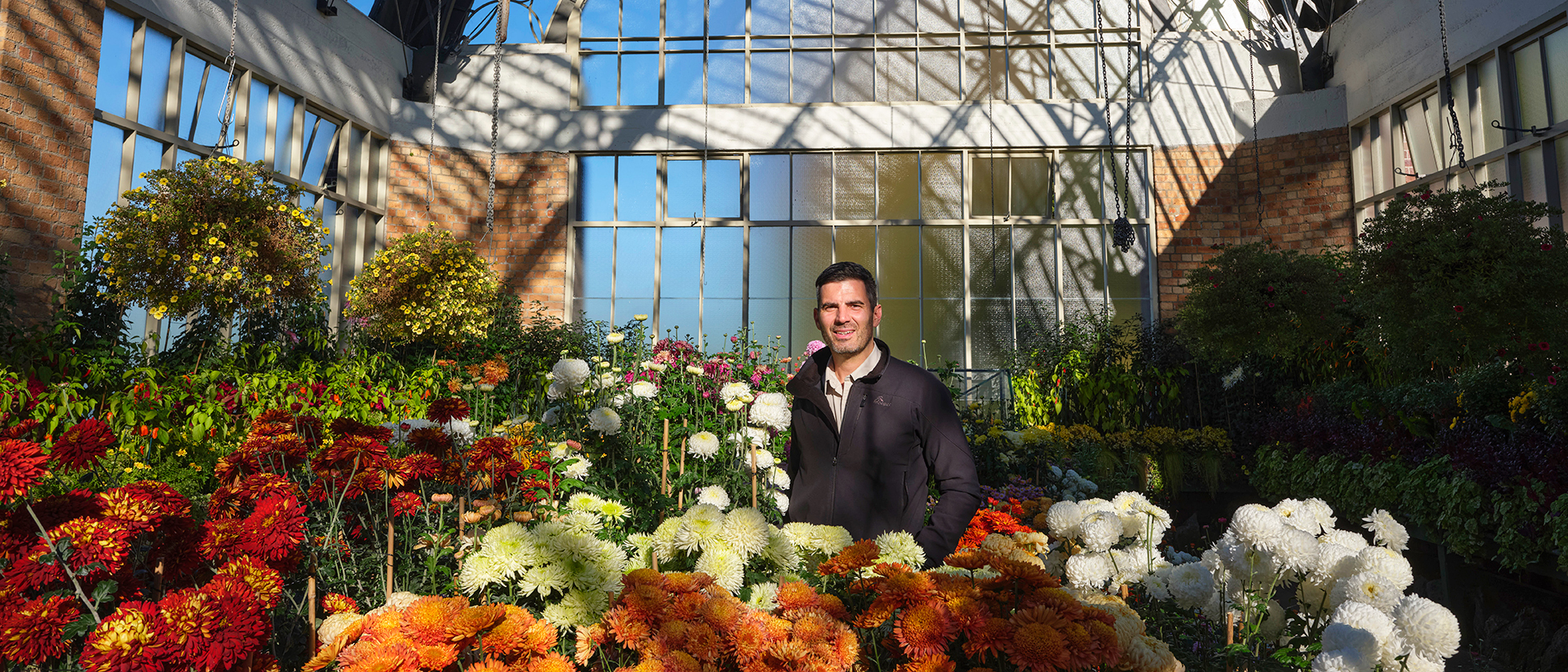
Behind the scenes: Auckland Wintergardens
10 March 2025
Visit the renovated Wintergardens in the Auckland Domain to experience the year-round beauty of blooms.

We thought: the Catlins, that should be awesome – all those sea lions and rare little penguins, massive elephant seals lolling about, not to mention seabirds – it would be a winter wildlife safari.
But when we arrived it seemed that all the creatures starring in every website and guide to the Catlins had gone on holiday themselves.
At every location – whether lonely Cannibal Bay or Surat Bay, Nugget Point, Curio Bay or Waipapā Point and all points in between – our Attenborough style close-ups with sea creatures failed to materialise. But it made not one jot of difference to our enjoyment of the Catlins. It was still awesome.

What a fantastically unspoiled, weather-beaten place. Landscapes shaped by roaring southerly gales and pounding seas have sculpted the coastline into a series of cliffs, caves, rocks stacks and empty, wide sand beaches nestled between windswept headlands where lighthouses paint the inky blackness.
Inland, we found lonely rural settlements dotted amidst picture-book farmland, countryside studded with sheep; along riverbanks, tracts of ancient forest were mirrored on glassy surfaces. All the while the distinctive winter light painted the scenery in a way that presented endless photographic opportunities.
This was a drive to savour, speed dial turned way down, soaking in the silence and enormous night sky; basking in that privileged feeling of knowing we were in a special place.
In the Catlins Coastal Rainforest Park we went looking for the justly famous, beautiful waterfalls of Purakaunui and McLean on well-managed tracks meandering beneath towering rimu, rātā, kāmahi and silver beech. It felt primeval walking through the moss-covered, dripping rainforest, under giant tree ferns and blistering red bark of fuchsia limbs, following the sound of water to the cascades.

Not far away, Nugget Point lighthouse, the star of any number southern New Zealand travel brochures, didn’t disappoint. It’s the lighthouse’s dramatic placement on a narrow, hilly promontory looking out over a series of conical rocks, the nuggets, poking out of the sea as though scattered by the sweep of a giant hand eons ago, that sets it apart from other sentinels. At sunset the last rays of sun strike the nuggets; fiery orange teeth glow on a darkening sea.
The untainted loveliness of the Catlins reaches its zenith westwards at Tautuku Bay. Here, a broad expanse of coastal forest is brought to a halt by a long sweeping curve of golden sand, upon which waves break in latticework patterns. This is best viewed from Florence Hill which overlooks it, from where I sent up my drone.
Hidden from the main road and from the beach, but not from my drone, was Lake Wilkie, a bog lake formed after the last ice age. Viewed directly from above, it has the shape of South America.

Curio Bay caters almost exclusively to holidaymakers, comprising just a few dozen holiday homes, guesthouses and a campsite. In winter it was deserted. At low tide a petrified forest, some 180 million years old, can be examined. Signs told us of a yellow-eyed penguin colony, one of the rarest of all the penguin species, but we didn’t see any.
At this stage of our Catlins journey we had almost reached the most southerly point of the mainland. That exact spot is a short drive from Curio Bay at Slope Point. We took our selfie on the cliff by the signpost pointing to the equator north and Antarctica the other way; nothing but the wild ocean stretched out between us and the icy continent.

Nearby, a much-photographed line of macrocarpa trees has been blown and shaped in extraordinary fashion, like a huge head of hair slicked flat by the gel-effect of incessant gales. It’s a reminder, if one were needed, of how the great Southern Ocean dominates every facet of life here.
Waipapā Point Lighthouse brings this vulnerability to nature home. The lighthouse, first lit in January 1884, was built in response to the wreck of passenger steamer Tararua off Waipapā Point in 1881. That disaster claimed 131 lives.
The lighthouse stands on a lonely point of wave-lashed coastline, its white paintwork gleaming against a darkening sky. Above foam-spitted rocks, flocks of terns and gulls wheeled and screeched on a wind from the icy south, raw and bracing, spitting freezing raindrops, driving us back to the car.
Story by Mark Meredith for the Winter 2024 issue of AA Directions Magazine. Mark Meredith is a freelance writer and photographer who regularly contributes to AA Directions magazine.